Cultural Site Preservation O’ahu, Hawaii
Tactica Solutions assisted the on-going effort at Ka’ena Point Satellite Tracking Station to determine the location of a possible new radar for the Missile Defense Agency. Specifically, we established a perimeter around two cultural sites to avoid encroachment, contamination or site destruction by the crews coming in to take core samples of the soil. We utilized satellite imagery and a mobile global positioning system to install delineator posts at or around 30 meters from the cultural site, creating a noticeable nonintrusive barrier.
Project at a Glance
- Location: Ka’ena Point Satellite Tracking Station O’ahu, Hawaii
- Our Role: Installed a protective barrier around two historic cultural sites | GPS locations of all posts installed on the ground | Created a map outlining the delineator posts installed on the site
- Project Metrics: Delineator post places at least 30 meters from the cultural site | Delineator posts were flagged and placed with five feet of fencing followed by ten feet of open space for cattle to access | GPS position was located and placed on a map of endangered species of plant life
ePRISMS Data Collection and Development
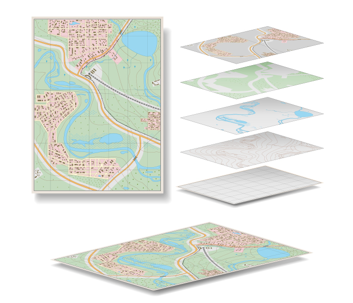
ePRISMS is the Army’s Enterprise solution for space utilization management. It provides visibility to floor plans, maps, imagery, and readiness data consolidated from multiple Headquarters, Department of the Army (HQDA) systems including Headquarters Installation Information System (HQIIS), General Financial Enterprise Business System (GFEBS), Installation Status Report (ISR), Army Stationing and Installation Plan (ASIP), and Real Property Planning and Analysis System (RPLANS), enabling sound strategic-investment decisions, space optimization, and cost savings. Tactica has provided expert Computer-Aided Design and Drafting (CADD) support to U.S. Army installations, including data collection and processing, quality control, document management and data repository solutions. Tactica has performed ePRISMS data collection and development allowing U.S. Army installations to have standardized baselines of all building data sets.
Project at a Glance
- Location: Fort Sill, OK | Picatinny Arsenal, NJ | Fort Benning, GA
- Our Role: Floor plan development | Facility utilization surveys | Space and manpower data
- Project Metrics: 20 million squ are feet of facilities collected | 1000 facility asset verification | Force strength captured for all facilities
116th Military Intelligence Brigade (MIB) Aerial Intelligence, Surveillance, & Reconnaissance (AISR) Systems Engineering & Technical Assistance (SETA) Support
Tactica provides Staff Operations support to the 116th MIB and its subordinate Processing, Exploitation, and Dissemination (PED) BN S1 (Personnel), S2 (Security), S3 (Operations), and S4 (Logistics) offices. We deliver AISR subject matter expertise that enables and advances the Brigade’s mission of conducting expeditionary and remote austere environment Aerial ISR and Target Acquisition (ISR/TA), and associated Collection, Processing, Exploitation, Dissemination (CPED) of intelligence in support of worldwide Army Multi-Domain Operations and Joint requirements. The operational, administrative, security, and logistical support we provide within the Brigade enables synchronization of the global Army Aerial ISR-TA Enterprise and
Project at a Glance
- Location: Fort Gordon, GA
- Our Role: Operations & Planning | Intel Capabilities Development | Force Management | Signals Intelligence (SIGINT) | Geospatial Intelligence (GEOINT) | Training Management | SIGINT/Electronic Intelligence (ELINT) Training Dev & Instruction | Graphics Illustration | Special Security Office | Military Affairs Liaison | Human Resources
- Project Metrics: 20 million squ are feet of facilities collected | 1000 facility asset verification | Force strength captured for all facilities
CAPABILITIES

General Fund Enterprise Business System (GFEBS)
General Fund Enterprise Business System (GFEBS)
- Validate, reconcile, and correct all real property line items within GFEBS
- Update all required supporting documentation within the real property record
- Bring all real property records into audit compliance, taking whatever action is needed (real property photos, real property identifiers, creating/organizing real property folders)

Military Master Planning
Military Master Planning
- Requirements analysis processes following the principle methodology defined in the IMCOM Space Planning Criteria Manual text
- Planning Charrette to produce DD Form 1391 accurately capturing desired scope, justification and cost of the mission with supporting documentation
- Facility Utilization Studies
- Area Development and Area Development Execution Plans